![[gpndg]](../New-gpndg.gif)
|
| 2006 |
The 15th Annual GPNDG
August 24-27, 2006
Crescent Lake, Oregon
N 43° 29.209' W 121° 57.512'
|
|
| 2006 |
N 43° 29.209' W 121° 57.512'
| Maps • Activities • Rules • Register • Who's Signed Up? |
Note: Maps refer to GPNDG'97, but this year's GPNDG is at the same site...
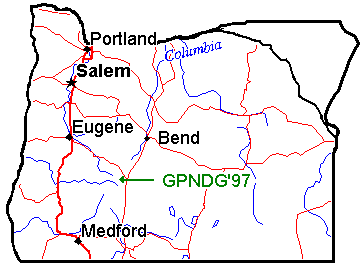
Here's a map of the State of Oregon showing the general location.
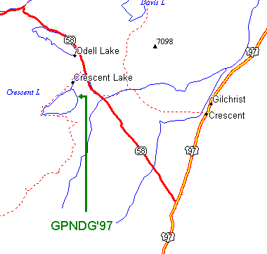
And here's a more localized map of the Crescent Lake area
with Oregon Highway 58, and US Highway 97 marked.
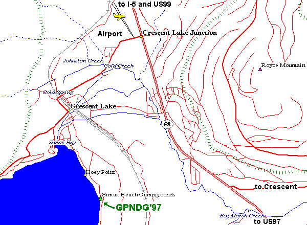
Here's a very detailed map showing the main routes into the site,
and includes the location of the Airport (for Lissa's benefit).
12.2 miles west on Road 61 3.5 miles north on Hwy 58 2.2 miles west on Road 60 1 mile south on Road 6005
| 461 miles — | Spokane, WA |
| 358 miles — | Seattle, WA |
| 185 miles — | Portland, OR |
| 74 miles — | Bend, OR |
| 78 miles — | Eugene, OR |
| 100 miles — | Klamath Falls, OR |
| 171 miles — | Weed, CA |
| 359 miles — | Reno, NV |
| 488 miles — | San Jose, CA |
| 898 miles — | Escondido, CA |
| 2,398 miles — | Columbus, OH |
| 5,036 miles — | Milan, Italy |
Note: these milages are for the most direct (and probably boring) routes...
Link back to GPNDG 2006 page...