Maps to GPNDG'97

Set your GPS target to: N 43° 29.209' — W 121° 57.512'


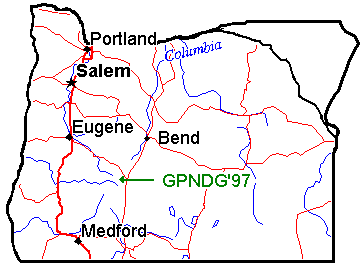
Here's a map of the State of Oregon showing the general location.


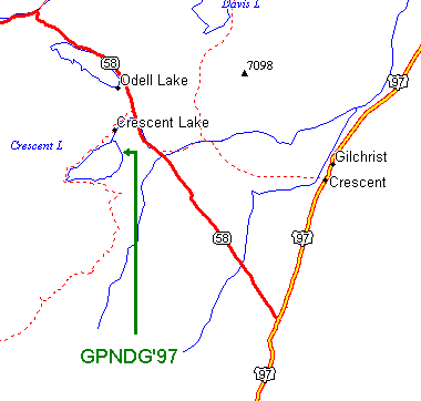
And here's a more localized map of the Crescent Lake area
with Oregon Highway 58, and US Highway 97 marked.


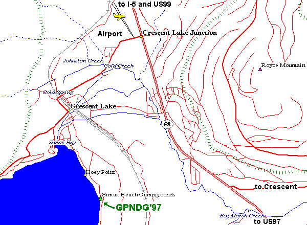
Here's a very detailed map showing the main routes into the site,
and includes the location of the Airport (for Lissa's benefit).


Photos

Directions from Crescent, OR on US97:

12.2miles west on Road 61
3.5miles north on Hwy 58
2.2miles west on Road 60
1mile south on Road 6005


Distances from various cities:

461 miles —Spokane, WA
358 miles —Seattle, WA
185 miles —Portland, OR
74 miles —Bend, OR
78 miles —Eugene, OR
100 miles —Klamath Falls, OR
171 miles —Weed, CA
359 miles —Reno, NV
488 miles —San Jose, CA
898 miles —Escondido, CA
2,071 miles —Arlington Hts, IL
2,398 miles —Columbus, OH

Note: these milages are for the most direct (and probably boring) routes...


counter visits to this page since July 24th, 1996