![[GPNDG]](/New-gpndg.gif)
|

|
|
The 21st Annual GPNDG
August 9-12, 2012 White Bird, ID N 45° 44.591' — W 116° 19.525' |
| Site • Crew • Maps • Register • Activities • Rules • Who's Signed Up? • Rides |
Scouting Trip Photos
I (HMarc) rode to the site on Tuesday, September 6th, 2011 from Spokane Valley, WA. I talked to the owner, Anna, resolved some issues (e.g. we'll need a couple of portapotties, and some serious bagged ice deliveries), and took these photos. I spent the night there to see what that was like — unfortunately in my efforts to pack light (everything in a single Ortlieb dry bag) I forgot my tent poles. So I slept on the ground.
It was 95°F before the sun went down, but the sun sets below the very high surrounding mountains fairly early. And as soon as the sun wasn't visible, the temperature dropped to a very comfortable 80°F (by about 6pm). The entire evening in the site was Very comfortable, temperature-wise. I am happy to report that sleeping in the open with a glorious sky full of stars was a pleasure. No bugs or critters bothered me, and I slept soundly and woke up with the daylight to a 57°F morning. Not even cold compared to Eagle Lake.
Photos & Notes
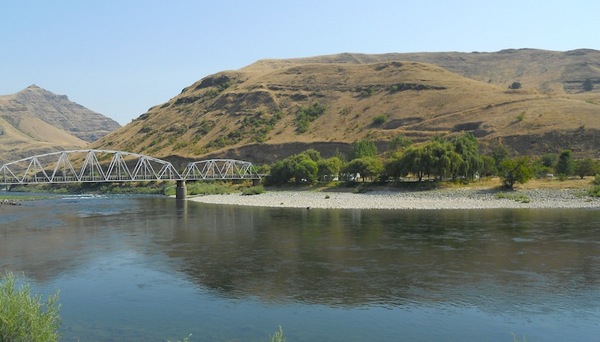
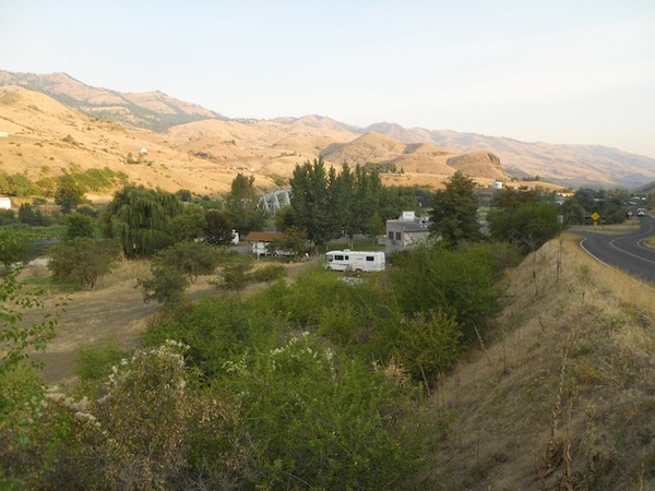
The site from across the river (looking logically east), on the road that goes up and over Pittsburg saddle (4,300') and down to the Snake river in Hells Canyon. The green trees from the bridge to the right side of the photo define the "usable" part of the site.
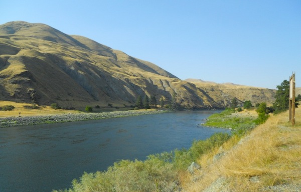
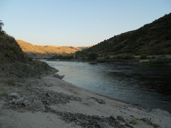
A shot upriver from the site on the Salmon, looking downstream.
Looking upriver from the edge of the grass near the gazebo.
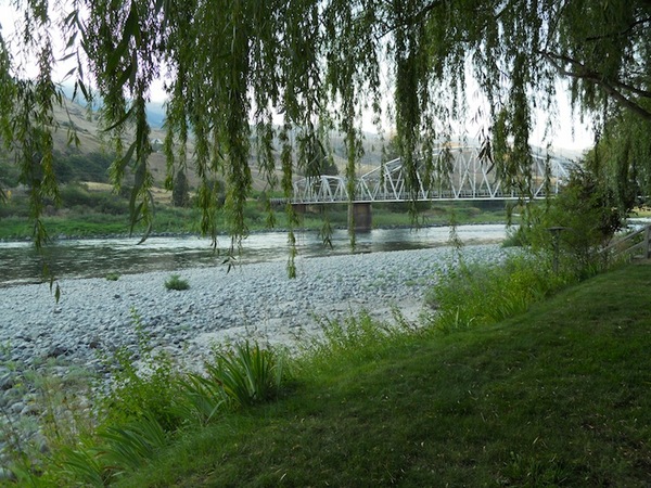
Looking towards the bridge from near the gazebo.

The gazebo. Airhead me forgot my tent poles, so I had to sleep on the ground in the open. It was fine, no bugs, no critters tried to bite me, and I slept soundly. Behind those chairs is a raised fire pit, about 3-4' in diameter.
The plan is to put the cooking area (under the big EasyUps we used at Eagle Lake) near, but not in, the gazebo — leaving the gazebo and fire pit for socalizing.
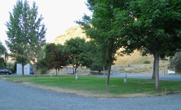
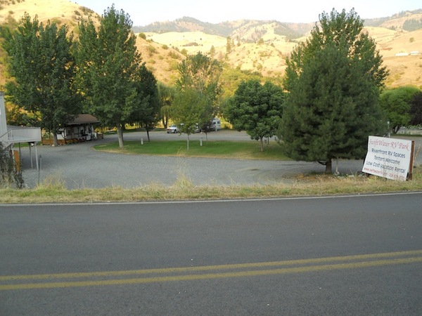
The center grass island. Lots of tents could fit there.
The gravel area comprises much of the site, and some of it was fairly deep and made turning the bike around and getting going a bit difficult. Some without confidence in gravel aren't going to like it. But it's a year away, and may well be packed down by then.
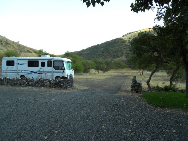
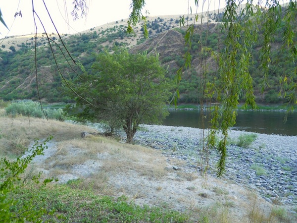
Ajacent BLM land which Anna has a permit for. We can park cars, trailers, etc there, just outside the site. The trail to the beach begins at the far center of the photo.
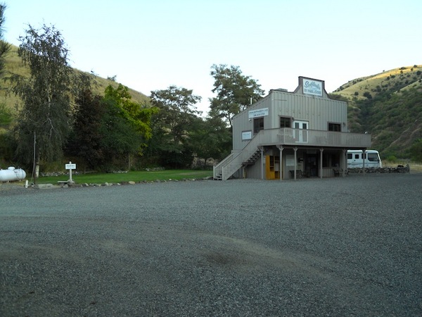
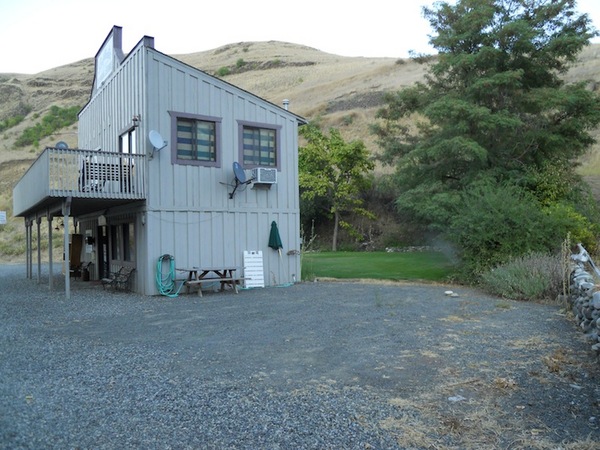
The "Store" part is history (but there is a small general store in White Bird, probably open just 9am-5pm, one mile away). Upstairs is private space. Downstairs is where the bathrooms and laundry are. Doors on the front and back of the building. There is also a pay phone there.
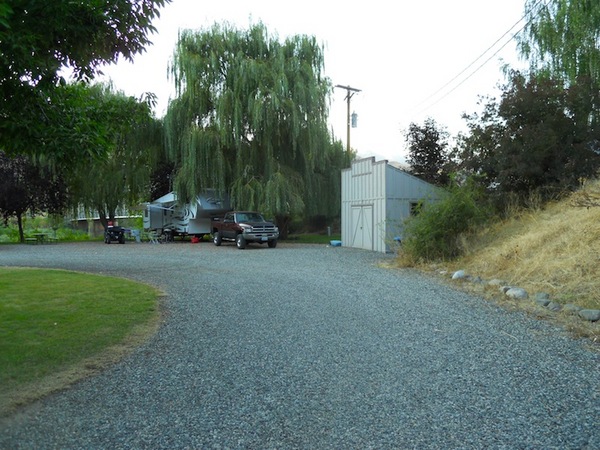
The far side of the site, nearest the bridge, has a storage shed. We might want to put one portapotty there to make a shorter walk for folks camping nearby.
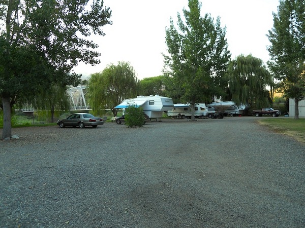
The area behind the main building has room for quite a few tents. We could put a couple more portapotties here near that picnic table. Bikes could also park here where the gravel isn't so deep.
The beach, such as it is. It's actually nicer than this photo shows, honest.
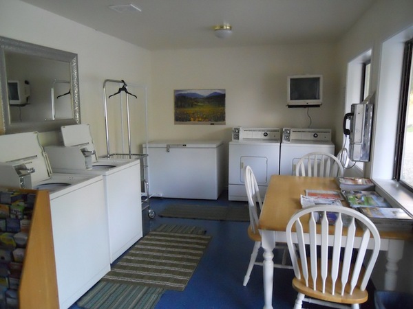
Two washers, two driers, a TV, a pay phone, and a freezer (part of which we could use).

Two nice bathrooms identical to this, each with a shower.
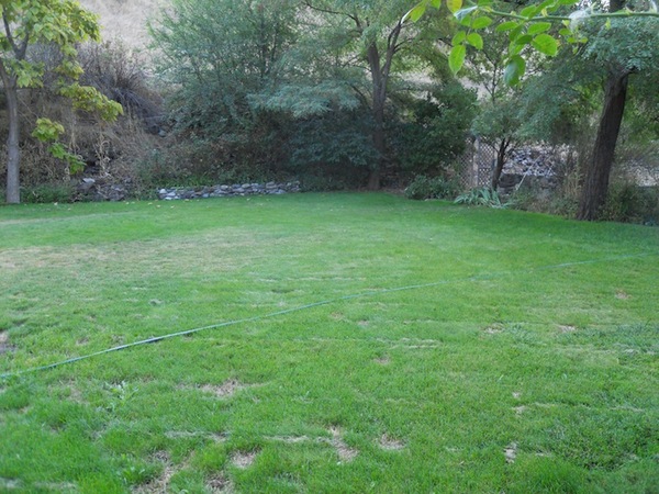
Another shot of the lawn behind the main building. The future Tent City™ of GPNDG #21.
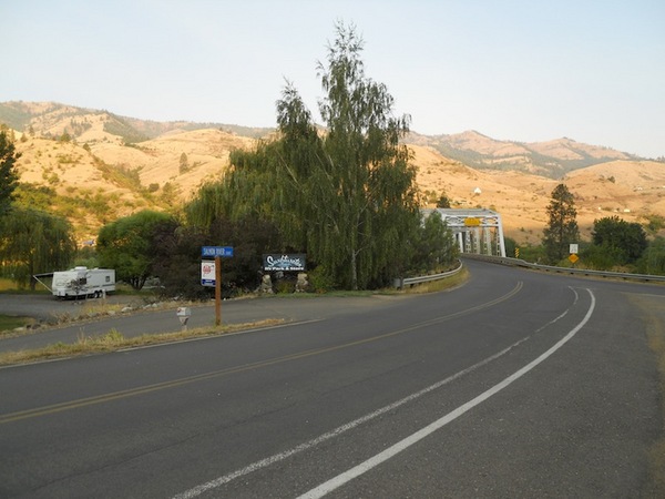
View from the road, the entrance is a 180° turn to the left.
View from the road.
View from the road leading to Hwy 95 (which was directly behind me about 1+ miles as I shot this photo). The site is from the white RV to the bridge.
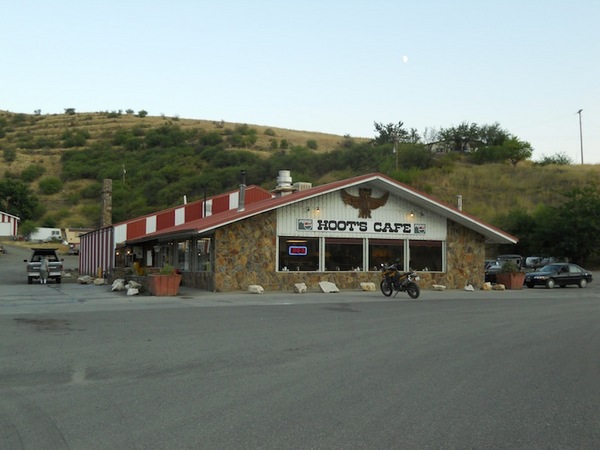
Cafe/Motel just up the hill on Hwy 95, about 2 miles from the site. Their phone number is (208) 839-2265. They have 16 motel rooms, $41 for a single bed, $54 for a two beds. As of just now, they are all (but the one I reserved) open. If you reserve one, tell 'em Marc sent you.
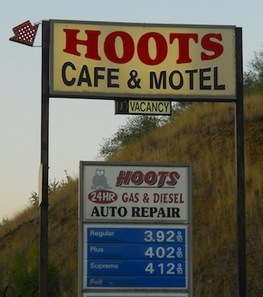
Fuel available there.
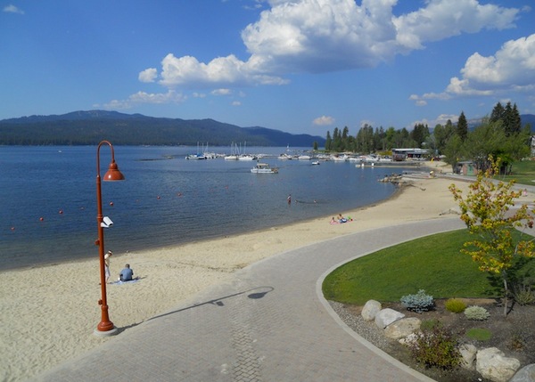
Payette Lake from the main street of McCall, ID. The 75-90 minute ride there is verra nize. McCall is at over 5,000' in elevation, and was about 81° here when it was at 95° at the site.
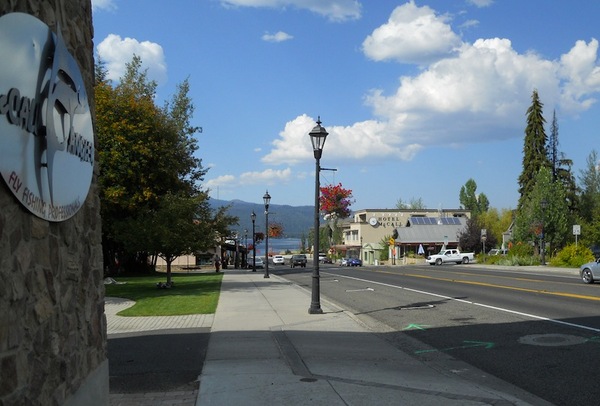
A block south of McCall's main street, looking logical north, on Hwy 55. There are lots of restaurants and services here. Google or your GPS or smartphone will help you find them.