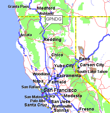
Here's a map of Northern California showing the general location.
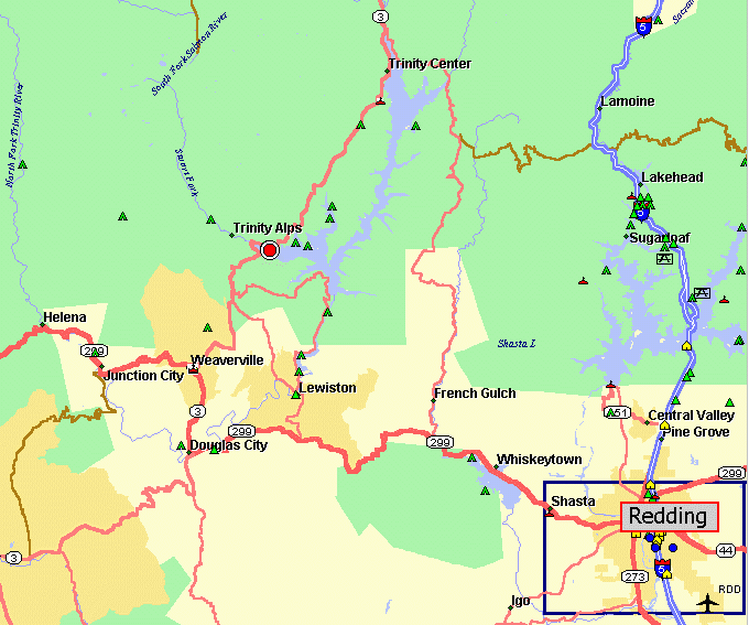
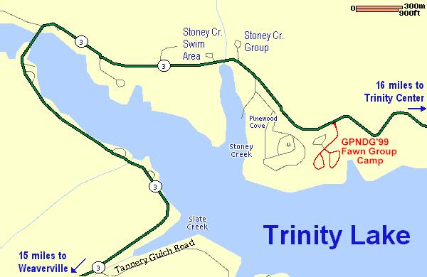
And here's a more localized map of the Trinity Alps area with Highway 299 and Highway 3 marked. The red & white dot is the campsite location.
Here's a map of Northern California showing the general location.
And here's a more localized map of the Trinity Alps area with Highway 299 and Highway 3 marked. The red & white dot is the campsite location.
A plain 'ol Rand McNally map of California will show Clair Engle lake just NW of Redding. Draw a straight line between Redding and Crescent City, CA, and you will just about bisect the campsite on the west side of Clair Engle lake.
748 miles — Spokane, WA
710 miles — Vancouver, BC
574 miles — Seattle, WA
395 miles — Portland, OR
118 miles — Klamath Falls, OR
510 miles — Boise, ID
259 miles — Reno, NV
312 miles — San Jose, CA
709 miles — Escondido, CA
2,094 miles — Elgin, IL
2,433 miles — Columbus, OH
Note: these milages are for the most direct (Interstate highway) routes...
| Back to GPNDG '99 Web page |